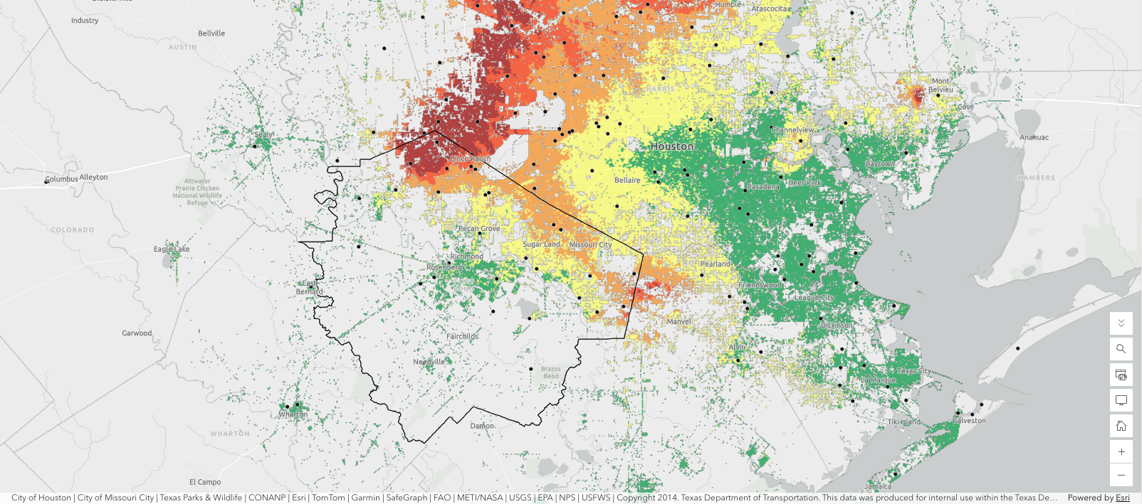
Residents can now see exactly how fast the ground beneath their homes is dropping, thanks to a new interactive map the Fort Bend Subsidence District published on Friday, Aug. 21.
The online tool combines two data sources: satellite radar imagery that shows land movement across the entire county, and GPS station readings that give precise, localized measurements at fixed points. Users can click any GPS station on the map to view its monitoring history and the total subsidence recorded there. The map is publicly accessible at arcg.is/0eL9DT0.
The satellite layer uses a technique called Interferometric Synthetic Aperture Radar, or InSAR, which compares radar images taken at different times to detect whether the ground is rising or sinking. The district says InSAR offers higher spatial resolution than other satellite technologies it has used. Casey Hughes of the district's Science and Research Program published the map.
The release comes less than three weeks after district General Manager Mike Turco delivered a pointed warning to the Fulshear City Council. At the council's Aug. 4 special meeting, Turco reported that the GPS monitoring site closest to Fulshear is sinking at more than 3 centimeters per year, the fastest rate anywhere in the district's network. He attributed the acceleration to regional groundwater demand that has roughly doubled since 1990, rising from about 100 million gallons a day to around 200 million, according to coverage of that meeting.
Turco told the council that differential sinking changes drainage patterns, alters where flooding happens and stresses roads, railroads and pipelines. Fulshear Council Member Randy Connor underscored the flood connection at the same meeting, noting that the stable areas on the district's subsidence maps sit just east of the fast-sinking zones and correspond to the Addicks and Barker reservoirs, where water backed up and flooded homes during Hurricane Harvey.
The stakes are not abstract. A regional analysis cited at the Aug. 4 meeting estimated the cost of unaddressed subsidence at roughly $600 million per 100-year flood event over a 50-year window.
The Fort Bend Subsidence District, created by the Texas Legislature in 1989, regulates groundwater withdrawal countywide to prevent the kind of sinking that worsens flooding and damages infrastructure. Groundwater levels in wells tapping the Chicot and Evangeline aquifers in northern Fort Bend County dropped more than 160 feet between 1990 and 2021, according to the district's groundwater report.
Fulshear sits in the district's Regulatory Area B, which was historically unregulated. Under a revised plan, Area B faces its first-ever groundwater reduction requirements beginning in 2035. Communities that do not adopt an approved reduction plan by that deadline must drop to 40% groundwater immediately. Kirsten Burns, a local geologist, represents Fulshear on the district's board.
The 2035 deadline makes the new map more than a curiosity. Residents and developers planning projects in western Fort Bend County now have a public tool to see which areas are sinking fastest before those regulatory requirements take effect.