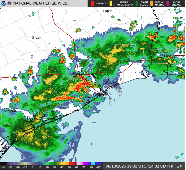
Scattered thunderstorms are moving through the Katy-Fulshear area Monday, Aug. 10, bringing the week's best chance of rain and a risk of isolated street flooding just hours before tens of thousands of students head back to class.
Lamar CISD opens its doors Tuesday, Aug. 11. Katy ISD, which serves more than 95,000 students, follows Wednesday, Aug. 12.
The National Weather Service Houston/Galveston office recorded 89°F with a heat index of 97°F at its Katy/Brookshire observation station by midday Monday under partly cloudy skies. The Weather Prediction Center placed parts of Southeast Texas under a Marginal Risk (level 1 of 4) for excessive rainfall.
Monday's storm threat
Monday's storms are forecast to be slow-moving afternoon downpours capable of producing gusty winds, frequent lightning and locally heavy rainfall. CW39 Houston meteorologist Idolina Peralez reported that widespread flooding is not expected, but "a strong, slow-moving storm could produce enough rain in a short period to cause street flooding or ponding in poor drainage areas."
Storm coverage across the Houston metro is forecast at 40–60%, with highs near 93°F. The cloud cover and rain will keep heat index values near 100°F, temporarily lower than what follows.
That relief is short-lived.
Heat builds through the week
Rain chances drop sharply Tuesday (30%) and stay low Wednesday and Thursday (20% each) before ticking back up slightly Friday (30%). High pressure strengthens, pushing temperatures into the upper 90s to near 100°F by Friday. The seven-day forecast calls for highs of 95°F Tuesday, 97°F Wednesday, 98°F Thursday, 99°F Friday and 98°F through the weekend.
The NWS Houston extended outlook warns of peak heat indices between 101°F and 108°F, with values exceeding advisory levels possible by midweek. No formal Heat Advisory has been issued for the area as of Monday, but conditions may warrant one later in the week. Overnight lows near 78°F all week will limit the body's ability to recover from daytime heat.
The NWS advises residents to check on elderly individuals, children and pets, stay hydrated and wear lightweight, light-colored clothing. Call 911 if someone shows signs of heat-related illness.
Flooding safety and local resources
The NWS "Turn Around, Don't Drown" guidance warns that six inches of moving water can knock a person down and 18–24 inches can sweep away most vehicles. Half of all Texas flood fatalities between 2014 and 2017 occurred in vehicles.
Katy-area residents in Harris County can monitor real-time bayou levels and rainfall data at harriscountyfws.org. The Katy area drains through the Willow Fork of Buffalo Bayou into Barker Reservoir.
Fort Bend County residents can track flooding conditions through the Fort Bend County Office of Homeland Security & Emergency Management or tune to AM 1670 for emergency alerts. The office can be reached at 281-342-3411.